
Depth estimation of the residualfield of Patigi Area, Nigeria , using source parameter imaging and spectral depth analysis
Keywords:
Aeromagnetic interpretation, Spectral depth, Source parameter imaging, Sedimentary thickness, Bida BasinAbstract
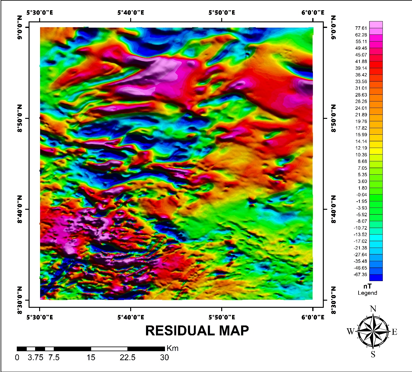
Aeromagnetic depth estimation was carried out over a one-half-degree sheet in the southwestern Bida Basin, Northcentral Nigeria. The area, bounded by latitudes 8◦30′–9◦0′ N and longitudes 5◦30′–6◦0′ E, is underlain by Campanian–Maastrichtian sandstones and basement rocks of granite-gneiss and migmatites. Potential field methods were applied to investigate subsurface sedimentary thickness. Regional–residual separation was achieved using polynomial fitting, and the residual field was analyzed using source parameter imaging (SPI) and power spectrum techniques for depth estimation around Pategi and environs. The residual map was subdivided into nine spectral sections to examine depth variations from magnetic sources. SPI results revealed depths ranging from 53.4m to 2766.5m, with a mean of 284.3m. Spectral analysis indicated shallow magnetic sources between 0.730km to 1.359km (average 1.100km) and deeper sources between 1.927km to 2.840km (average 2.333km). The maximum sedimentary thickness of 2.840km was found in the north-central area, including Pategi, Baradogi, Wando, and Edogi. These results indicate significant hydrocarbon potential. Integrated geological and geophysical studies are recommended to validate reservoir structures and assess viability for exploration.
Published
How to Cite
Issue
Section
Copyright (c) 2025 S. A. Salaudeen, T. A. Adagunodo, A. O. Busari, K. O. Suleman, L. A. Sunmonu

This work is licensed under a Creative Commons Attribution 4.0 International License.